Our 3D Land Survey Mapping Solutions use drone imagery and spatial data analysis to create accurate elevation models and topographic maps of your land for successful Precision Farming. Gain valuable insights for land use & development and design efficient field management strategies to tap the full potential of your land!
3D land survey
AGRISTRY Land Mapping can be used to generate Digital Elevation Models & Water Flow Models of your fields.
digital elevation model
generate digital surface & terrain models for land development and precision field management.
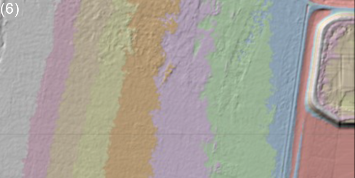
contour mapping
create Contour Maps to aid in understanding, predicting, and managing water resources.
Benefit from high resolution drone imagery and the calculation of various parameters for land surveys. Analyse precise surface & terrain maps to gain insightful information for land use & development, efficient field management and yield increase.
Our 3D Land Survey Mapping Solutions can provide deep insight into the section of land you are cultivating.
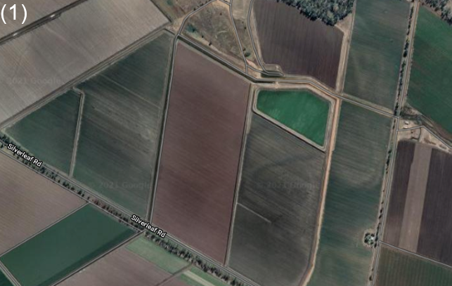
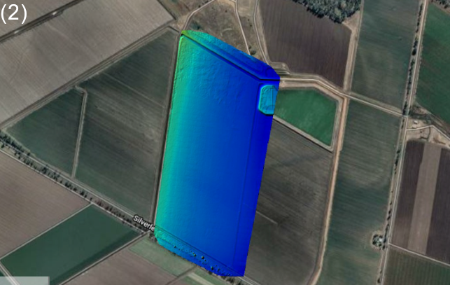
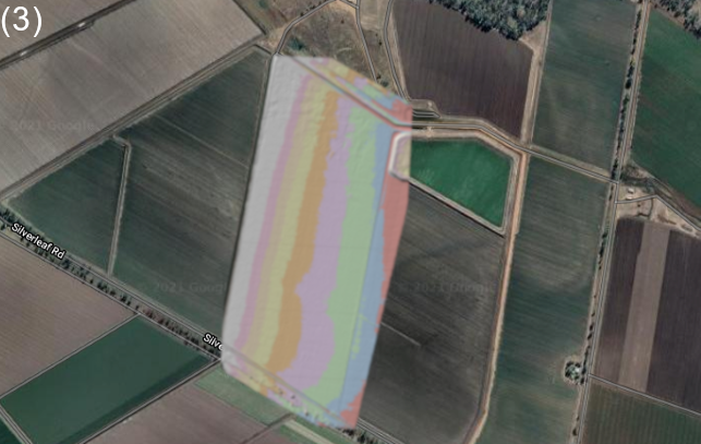
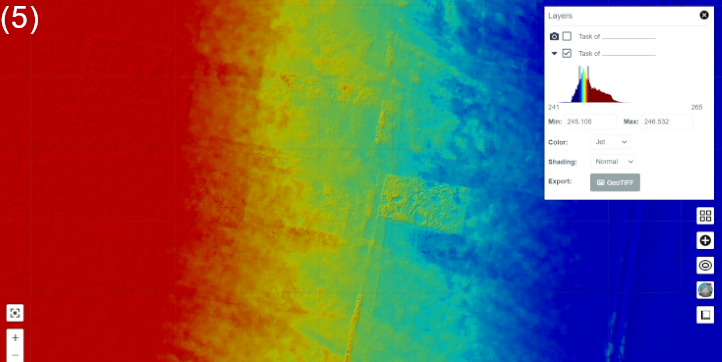
You can compare the orthophoto (1) to the surface model (2), and change the colour gradation/scheme (3) as required or preferred.
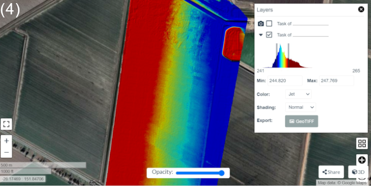
Move the slider bars to adjust the sensitivity (4), zoom in (5), and change the gradient range (6) to highlight certain elevation levels.
The generated modelssupport precise field assessment & management and aresuitable for use in laser levelling & earthworksas well. Examine the digital models for distinctive terrain or surface features, slope & aspect, elevation contours and water flow structures. Verify the results on-site to make informed decisions on land use & planning.
AGRISTRY - next level field analysis.
Be part of Progress
Benefit from Precision Agriculture Technology and optimise your productivity with AGRISTRY!
AGRISTRY is your way to autonomous Precision Farming. Map your fields to gain valuable insights and optimise management strategies. Achieve increased yields, reduced costs and better environmental outcomes!