crop mapping
Monitor crop growth & Needs
crop health
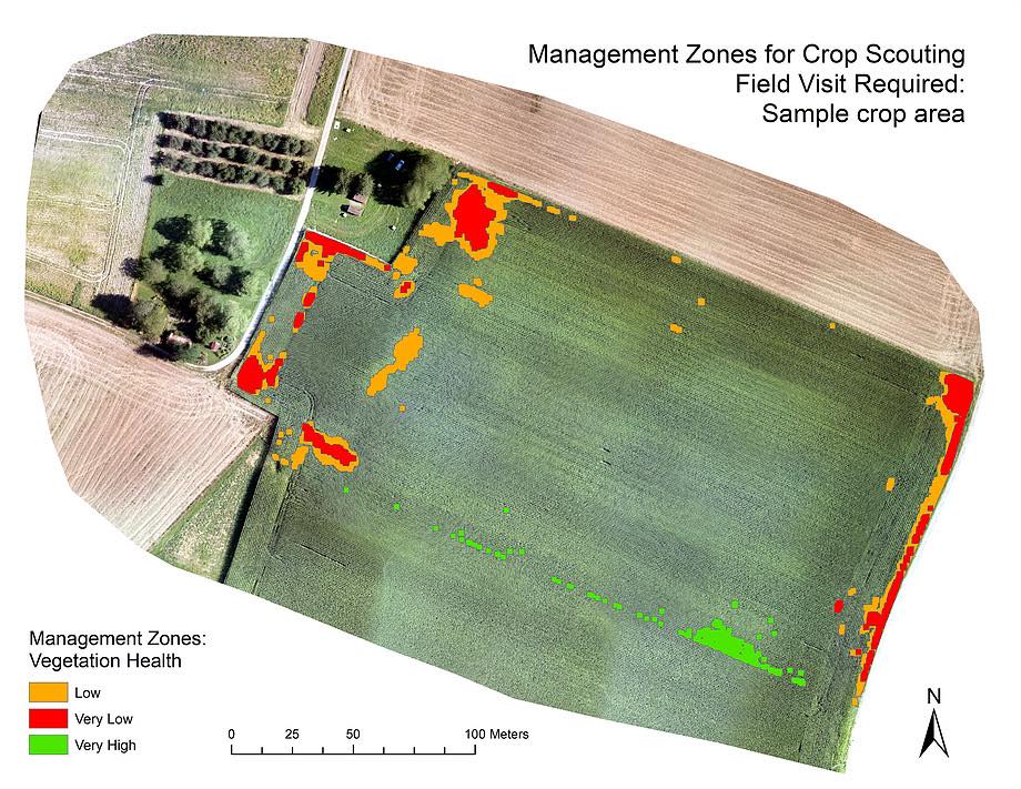
Our Crop Mapping Solutions are based on drone imagery analysis and the calculation of different parameters including plant indices. Create crop health maps and examine crop development all-season to design precise and efficient field management strategies. The generated maps can be downloaded as shapefiles for machinery integration and variable rate spraying.
crop growth monitoring
plant count
stress detection
harvest readiness
Our AGRISTRY software identifies patterns within the image data to create diagnostic field maps.
Benefit from computer vision, artificial intelligence, spatial technology and the visualisation of plant indices to monitor your fields!

crop health maps
- Generate a field map based on drone imagery analysis
- Analyse map to identify the health of field & crop sections using different parameters
- Investigate points of interest & problematic zones on-site
- Design precise treatment strategies after health mapping and inspection
- Execute strategies with the help of machinery integration
Precise crop care at every stage!
Is this the solution to your farming needs?
Great! Sign up and get started.
Need more information?
Keep on reading or get in touch.
More Solutions
Crop Health Monitoring is important, but there’s more you can do. Be prepared and get the full solution!
AGRISTRY solutions
- Maps for precision field analysis & 3D land surveys
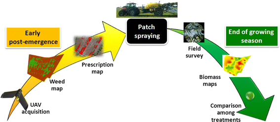
- Pre-season field mapping for weed detection & spraying
- Shapefiles for variable rate application & machinery integration
- Ongoing crop health & harvest readiness monitoring

weed mapping
Locate and treat weeds before they become a problem.
land mapping
Create 3D Land Survey Models to analyse the terrain.
We offer multiple types of analysis and diagnostic maps to facilitate efficient field management.
Take full advantage of drone field mapping for Precision Agriculture Solutions!
grow more with less
Take advantage of AGRISTRY solutions and do more with less resources, more sustainably.
Benefits
Sustainable
Improved Crop Quality
Improved Soil Longevity
Yield Increase
Increased Productivity
Increased Profit
Easy Integration
Machinery Integration
Workflow Integration
Input Reduction
Decreased Chemical Use
Time- and Cost-Saving
AGRISTRY is your way to autonomous Precision Farming. Map your fields to gain valuable insights and optimise management strategies. Achieve increased yields, reduced costs and better environmental outcomes!
