Benefit from drone mapping and computer vision to monitor your fields. To create insightful field maps with AGRISTRY, all you need to do is upload drone imagery to the platform. Our software identifies patterns within the image data for different types of field analysis. Use the maps to design efficient management strategies and easily transform results into shapefiles for machinery integration.
how it works
The AGRISTRY platform is easy to use and takes care of the complicated mapping processes for you.
map creation
Our software stitches the uploaded drone images together to generate accurate field maps.
map Analysis
Our Software analyses the created field maps to detect weeds and provide actionable insights.
Select one of our mapping solutions, analyse the results, gain valuable field insights and generate precision application maps.
Using different types of field mapping can help to fully understand the state of your field or crop. In combination with other methods, maps can provide the information needed to improve field potential, design targeted management strategies for Precision Farming applications and increase yield while reducing input.
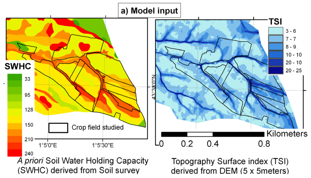
Terrain
depict field layout
DEM (elevation)
TSI (surface)
SWHC (water)
etc.
Plant Index
Determine Vegetation Health
NDVI
Nitrogen
CWSI
etc.
Biomass
Examine vegetation coverage
LAI (Leaf Area)
Chlorophyll
SAVI (Soil Adj.)
Etc.
other
object identification
plant count
weed detection
Etc.
generate Actionable insights.
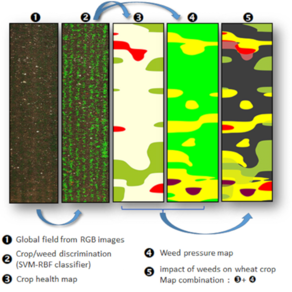
weed mapping
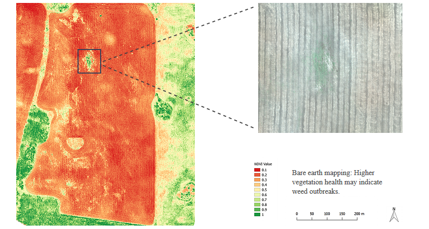
Weed detection and management is one important area of application. Our field analysis solution uses drone imagery to locate weeds before they become a problem so that effective spraying strategies can be designed and executed.
Non-destructive field monitoring can be used not only for weed detection but also to visualise various parameters and indices. Generate maps that show the condition of your fields and determine the needs of your crop.
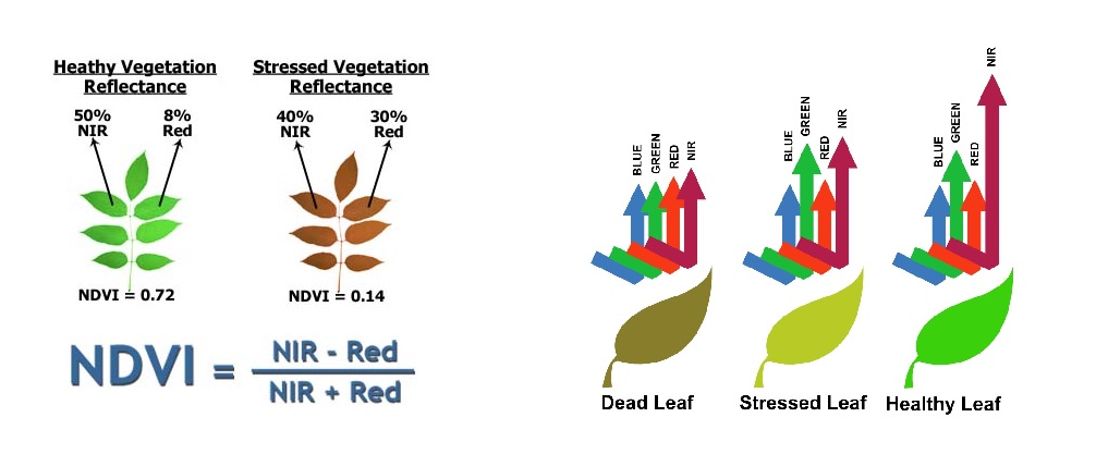
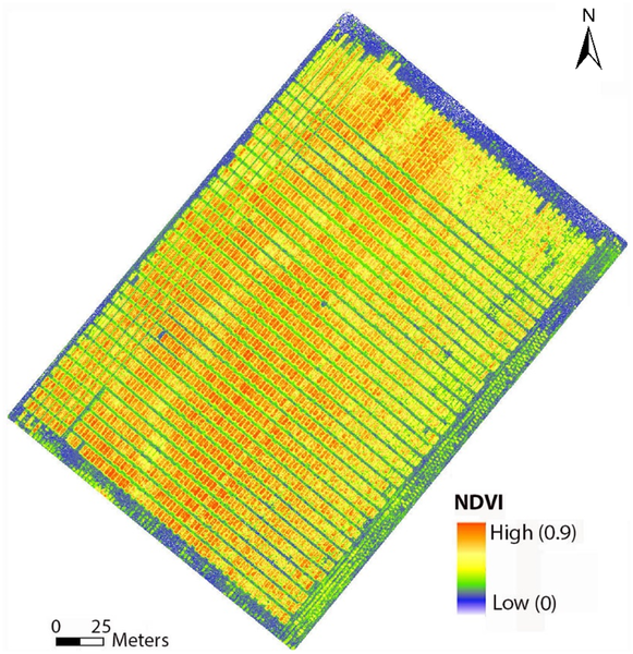
NDVI calculation and Example field map
The basic principle of NDVI relies o the fact that leaves reflect light not only visibly but also in the near infrared. When the plants become dehydrated or stressed, leaves reflect less NIR light, but the same amount in the visible range. Combining these two signals can help differentiate healthy plants from unhealthy plants.
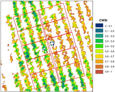
Water Maps examples
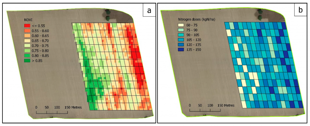
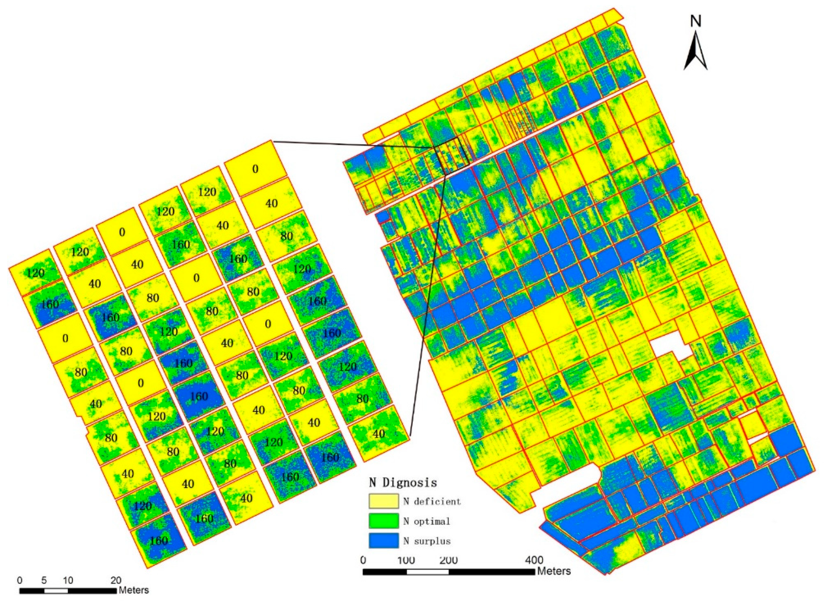
Nitrogen Maps examples
Elevation information and CWSI allow growers to find any irregularities in the field. They are useful in determining wet/dry spots which allow for more efficient watering techniques.
Nitrogen level monitoring allows for precise application of fertilizers, eliminating poor growing spots and improving soil health for years to come.
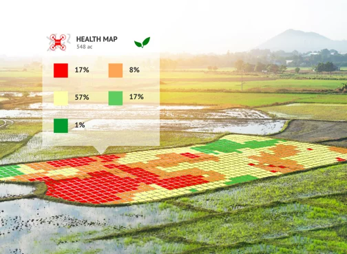
Crop Health Maps Examples
Drone based field mapping can be used to design efficient management solutions for various use-cases.
AGRISTRY is your way to autonomous Precision Farming. Map your fields to gain valuable insights and optimise management strategies. Achieve increased yields, reduced costs and better environmental outcomes!